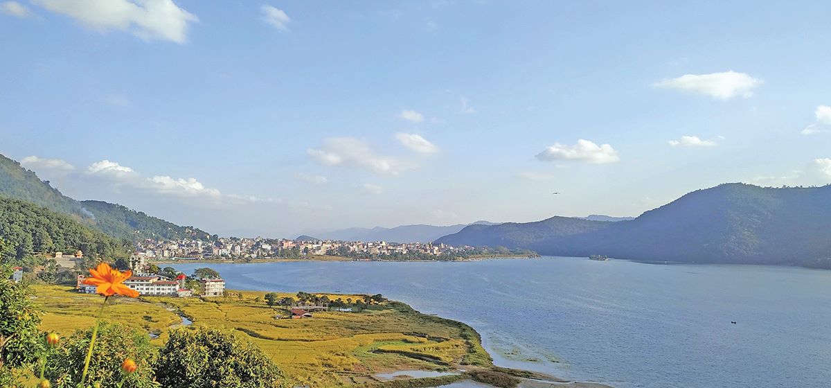
Lekhnath, July 18 – The boundary of Phewa Lake, a key landmark in Pokhara and one of Nepal’s major tourist attractions, has now been officially marked. A total of 611 boundary poles have been installed along a 16-kilometre stretch around the lake to define its high-water mark (flood level).
The demarcation work began on May 31, 2025, with representatives from the federal, provincial, and local governments working in coordination. Pokhara Mayor Dhanraj Acharya said the poles were placed in technically feasible locations as determined by an expert team, even in challenging areas such as slopes and ridges. The effort was supported by the municipal police, Nepal Police, Armed Police Force, and local communities.
Prakash Subedi, Chief of the Pokhara Valley Town Development Committee, informed that while 1,055 points were identified for marking, poles were installed only where physically possible. Alternative markers were used in submerged or inaccessible areas.
Authorities are now preparing for the second phase, which involves categorizing land within the lake and its 65-metre buffer zone. Land eligible for compensation and contaminated or encroached land will be identified. The third phase will involve distributing compensation to rightful landowners, after which the land will be vacated.
The Supreme Court had previously declared that land registered after the Phewa dam’s failure was illegal. Over 4,500 land parcels are believed to lie within the lake’s protected area. The lake has seen widespread encroachment over the years, with numerous buildings, hotels, and homes constructed within the restricted zone.
A 2018 Supreme Court mandamus had directed the government to demarcate the lake’s boundary, maintain a 65-metre buffer zone, and remove all illegal structures.